Saturday 20th August, 2011
 A soggy morning. I stayed in my tent for a while and eventually it eased off. I packed up in drizzle rather than a downpour. By the time I started walking it had cleared up well. Today’s walk is only 10 miles so I didn’t have to be in too much of a hurry.
The path goes along the south side of the canal to the small Loch Oich. There’s only about a mile of canal joining these two lochs. When I got to Loch Oich I went into the coffee shop at the Great Glen Water Park for a coffee and an orange juice. It seems like quite a nice place with log cabins scattered throughout the trees.
 Leaving the water park the path follows the bed of an old railway line. Part of a station platform can still be seen as can the stone walls that would have been alongside the sunken track. Trains used to run between Spean Bridge and Fort Augustus but the line was never successful due to rivalries between different companies.
The path then follows the remains of one of General Wade’s military roads. I sat for a while on a conveniently placed bench and looked across the loch to the ruins of Invergarry Castle. This used to be the seat of the MacDonald clan who supported the Jacobites and Bonnie Prince Charlie. It was burnt down after the battle of Culloden.

 After the castle the path moved slightly inland. When it returned to the lochside just before Aberchalder I was surprised at how windy it was beside the loch. Aberchalder has a rather pretty old bridge (The Bridge of Oich). It’s now only used by pedestrians. This is where Loch Oich ends and the canal begins again. I found a lovely tea garden just by the canal and the bridge and sat with coffee and a cake for a while enjoying the warmth. Now I was back near the canal and away from the loch, the wind had dropped and I hadn’t seen rain since this morning. The tea garden had a couple of resident dogs who insisted on playing catch with me, though one really hadn’t got the concept of the game and kept forgetting to bring the ball back to me.
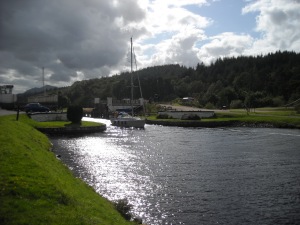
Just past the tea garden I crossed a bridge and followed the canal along a path on the north side. This was an even, flat path and, fortified by coffee and cake, I was able to get quite a pace going. I had a break at Kytra lock which was pretty and had nice grass for camping on, but no facilities. I considered stopping, but wanted to get another couple of miles under my belt, so carried on to Fort Augustus.
Fort Augustus is a busy little tourist town with the most people I’d seen since Glasgow. Because of the proximity to houses and businesses camping is not allowed at the lock and so I had to go up the road to the commercial campsite. This was a big campsite with several different camping areas. I was in a field for campers without vehicles. There were four young Spanish people with motorbikes and tents on the far side of the field from me, but that was it. It should have been a peaceful night. It wasn’t. The Spanish had set up a kind of communal tent as well as there own individual tents and proceeded to have a very loud party. If it wasn’t so annoying, I would have been quite impressed by how much noise could emanate from just four people! I ended up getting quite nowty and shouting over to them to shut up. To their credit, they did, and I was able to get a bit of sleep.
Distance walked = 10 miles


